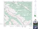
Maps showing Ruby Mountain, 44-22-W5, Alberta
Ruby Mountain is a Mountain located in 44-22-W5, Alberta and has an elevation of 2563 meters.
- Latitude: 52° 46' 26'' North (decimal: 52.7738889)
- Longitude: 117° 6' 26'' West (decimal: -117.1072221)
- Topography Feature Category: Mountain
- Geographical Feature: Mountain
- Canadian Province/Territory: Alberta
- Elevation: 2563 meters
- Location: 44-22-W5
- Atlas of Canada Locator Map: Ruby Mountain
- GPS Coordinate Locator Map: Ruby Mountain Lat/Long
Ruby Mountain NTS Map Sheets