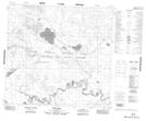
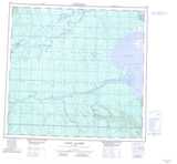
Maps showing Ruis Lake, 108,109-23-W4, Alberta
Ruis Lake is a Lake located in 108,109-23-W4, Alberta and has an elevation of 244 meters.
- Latitude: 58° 25' 25'' North (decimal: 58.4236110)
- Longitude: 113° 48' 39'' West (decimal: -113.8108333)
- Topography Feature Category: Lake
- Geographical Feature: Lake
- Canadian Province/Territory: Alberta
- Elevation: 244 meters
- Location: 108,109-23-W4
- Atlas of Canada Locator Map: Ruis Lake
- GPS Coordinate Locator Map: Ruis Lake Lat/Long
Ruis Lake NTS Map Sheets