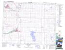
Maps showing Frankburg, 21-18-27-W4, Alberta
Frankburg is a Unincorporated area located in 21-18-27-W4, Alberta.
- Latitude: 50° 32' North (decimal: 50.5333000)
- Longitude: 113° 38' West (decimal: -113.6332999)
- Topography Feature Category: Unincorporated area
- Geographical Feature: Locality
- Canadian Province/Territory: Alberta
- Location: 21-18-27-W4
- GPS Coordinate Locator Map: Frankburg Lat/Long
Frankburg NTS Map Sheets