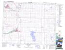
Maps showing Frank Lake, 18,19-27,28-W4, Alberta
Frank Lake is a Lake located in 18,19-27,28-W4, Alberta and has an elevation of 1005 meters.
- Latitude: 50° 32' 56'' North (decimal: 50.5488889)
- Longitude: 113° 41' 53'' West (decimal: -113.6980556)
- Topography Feature Category: Lake
- Geographical Feature: Lake
- Canadian Province/Territory: Alberta
- Elevation: 1005 meters
- Location: 18,19-27,28-W4
- Atlas of Canada Locator Map: Frank Lake
- GPS Coordinate Locator Map: Frank Lake Lat/Long
Frank Lake NTS Map Sheets