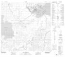
Maps showing Fraser Bay, 112-7-W4, Alberta
Fraser Bay is a Bay located in 112-7-W4, Alberta and has an elevation of 225 meters.
- Latitude: 58° 43' 54'' North (decimal: 58.7316666)
- Longitude: 111° 6' 19'' West (decimal: -111.1052778)
- Topography Feature Category: Bay
- Geographical Feature: Bay
- Canadian Province/Territory: Alberta
- Elevation: 225 meters
- Location: 112-7-W4
- Atlas of Canada Locator Map: Fraser Bay
- GPS Coordinate Locator Map: Fraser Bay Lat/Long
Fraser Bay NTS Map Sheets