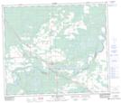
Maps showing Freeman River, 34-62-6-W5, Alberta
Freeman River is a Unincorporated area located in 34-62-6-W5, Alberta and has an elevation of 696 meters.
- Latitude: 54° 23' 59'' North (decimal: 54.3997222)
- Longitude: 114° 49' 25'' West (decimal: -114.8236111)
- Topography Feature Category: Unincorporated area
- Geographical Feature: Locality
- Canadian Province/Territory: Alberta
- Elevation: 696 meters
- Location: 34-62-6-W5
- Atlas of Canada Locator Map: Freeman River
- GPS Coordinate Locator Map: Freeman River Lat/Long
Freeman River NTS Map Sheets