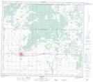
Maps showing Friedenstal, 25-81-3-W6, Alberta
Friedenstal is a Unincorporated area located in 25-81-3-W6, Alberta and has an elevation of 632 meters.
- Latitude: 56° 2' 39'' North (decimal: 56.0441666)
- Longitude: 118° 20' 11'' West (decimal: -118.3363888)
- Topography Feature Category: Unincorporated area
- Geographical Feature: Locality
- Canadian Province/Territory: Alberta
- Elevation: 632 meters
- Location: 25-81-3-W6
- Atlas of Canada Locator Map: Friedenstal
- GPS Coordinate Locator Map: Friedenstal Lat/Long
Friedenstal NTS Map Sheets