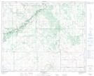
Maps showing Genest Lake, 38,39-9-W4, Alberta
Genest Lake is a Lake located in 38,39-9-W4, Alberta and has an elevation of 735 meters.
- Latitude: 52° 19' 4'' North (decimal: 52.3177777)
- Longitude: 111° 11' 31'' West (decimal: -111.1919443)
- Topography Feature Category: Lake
- Geographical Feature: Lake
- Canadian Province/Territory: Alberta
- Elevation: 735 meters
- Location: 38,39-9-W4
- Atlas of Canada Locator Map: Genest Lake
- GPS Coordinate Locator Map: Genest Lake Lat/Long
Genest Lake NTS Map Sheets