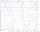
Maps showing Berry Creek, 36-28-12-W4, Alberta
Berry Creek is a Unincorporated area located in 36-28-12-W4, Alberta.
- Latitude: 51° 26' 17'' North (decimal: 51.4380555)
- Longitude: 111° 34' 25'' West (decimal: -111.5736110)
- Topography Feature Category: Unincorporated area
- Geographical Feature: Locality
- Canadian Province/Territory: Alberta
- Location: 36-28-12-W4
- Atlas of Canada Locator Map: Berry Creek
- GPS Coordinate Locator Map: Berry Creek Lat/Long