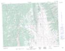
Maps showing Big Coulée, 10-2-W5, Alberta
Big Coulée is a Valley located in 10-2-W5, Alberta and has an elevation of 1323 meters.
- Latitude: 49° 48' 22'' North (decimal: 49.8061110)
- Longitude: 114° 9' 41'' West (decimal: -114.1613888)
- Topography Feature Category: Valley
- Geographical Feature: Coulée
- Canadian Province/Territory: Alberta
- Elevation: 1323 meters
- Location: 10-2-W5
- Atlas of Canada Locator Map: Big Coulée
- GPS Coordinate Locator Map: Big Coulée Lat/Long