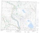
Maps showing Big Hay Lake, 48,49-22,23-W4, Alberta
Big Hay Lake is a Lake located in 48,49-22,23-W4, Alberta and has an elevation of 754 meters.
- Latitude: 53° 10' 4'' North (decimal: 53.1677777)
- Longitude: 113° 10' 35'' West (decimal: -113.1763888)
- Topography Feature Category: Lake
- Geographical Feature: Lake
- Canadian Province/Territory: Alberta
- Elevation: 754 meters
- Location: 48,49-22,23-W4
- Atlas of Canada Locator Map: Big Hay Lake
- GPS Coordinate Locator Map: Big Hay Lake Lat/Long
Big Hay Lake NTS Map Sheets