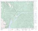
Maps showing Bighorn Canyon, 25-39-17-W5, Alberta
Bighorn Canyon is a Valley located in 25-39-17-W5, Alberta.
- Latitude: 52° 23' 5'' North (decimal: 52.3847221)
- Longitude: 116° 19' 50'' West (decimal: -116.3305556)
- Topography Feature Category: Valley
- Geographical Feature: Canyon
- Canadian Province/Territory: Alberta
- Location: 25-39-17-W5
- Atlas of Canada Locator Map: Bighorn Canyon
- GPS Coordinate Locator Map: Bighorn Canyon Lat/Long
Bighorn Canyon NTS Map Sheets