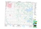
Maps showing Big Island Lake, 52-22-W4, Alberta
Big Island Lake is a Lake located in 52-22-W4, Alberta and has an elevation of 727 meters.
- Latitude: 53° 29' 19'' North (decimal: 53.4886111)
- Longitude: 113° 11' 58'' West (decimal: -113.1994443)
- Topography Feature Category: Lake
- Geographical Feature: Lake
- Canadian Province/Territory: Alberta
- Elevation: 727 meters
- Location: 52-22-W4
- Atlas of Canada Locator Map: Big Island Lake
- GPS Coordinate Locator Map: Big Island Lake Lat/Long
Big Island Lake NTS Map Sheets