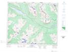
Maps showing Bingley Peak, 45-5-W6, Alberta
Bingley Peak is a Mountain located in 45-5-W6, Alberta.
- Latitude: 52° 54' 0'' North (decimal: 52.9000000)
- Longitude: 118° 37' 30'' West (decimal: -118.6250000)
- Topography Feature Category: Mountain
- Geographical Feature: Peak
- Canadian Province/Territory: Alberta
- Location: 45-5-W6
- Atlas of Canada Locator Map: Bingley Peak
- GPS Coordinate Locator Map: Bingley Peak Lat/Long
Bingley Peak NTS Map Sheets