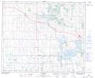
Maps showing Birch Lake, 50-11,12-W4, Alberta
Birch Lake is a Lake located in 50-11,12-W4, Alberta and has an elevation of 640 meters.
- Latitude: 53° 19' 19'' North (decimal: 53.3219440)
- Longitude: 111° 34' 47'' West (decimal: -111.5797219)
- Topography Feature Category: Lake
- Geographical Feature: Lake
- Canadian Province/Territory: Alberta
- Elevation: 640 meters
- Location: 50-11,12-W4
- Atlas of Canada Locator Map: Birch Lake
- GPS Coordinate Locator Map: Birch Lake Lat/Long
Birch Lake NTS Map Sheets