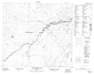
Maps showing Birchwood Creek, 21-91-14-W4, Alberta
Birchwood Creek is a River located in 21-91-14-W4, Alberta.
- Latitude: 56° 54' 19'' North (decimal: 56.9052777)
- Longitude: 112° 11' 2'' West (decimal: -112.1838888)
- Topography Feature Category: River
- Geographical Feature: Creek
- Canadian Province/Territory: Alberta
- Location: 21-91-14-W4
- Atlas of Canada Locator Map: Birchwood Creek
- GPS Coordinate Locator Map: Birchwood Creek Lat/Long
Birchwood Creek NTS Map Sheets