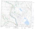
Maps showing Bittern Lake, 46,47-21,22-W4, Alberta
Bittern Lake is a Lake located in 46,47-21,22-W4, Alberta and has an elevation of 736 meters.
- Latitude: 53° 3' 6'' North (decimal: 53.0516667)
- Longitude: 113° 4' 13'' West (decimal: -113.0702778)
- Topography Feature Category: Lake
- Geographical Feature: Lake
- Canadian Province/Territory: Alberta
- Elevation: 736 meters
- Location: 46,47-21,22-W4
- Atlas of Canada Locator Map: Bittern Lake
- GPS Coordinate Locator Map: Bittern Lake Lat/Long
Bittern Lake NTS Map Sheets