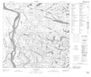
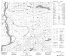
Maps showing Ryan Creek, 118-9-W4, Alberta
Ryan Creek is a River located in 118-9-W4, Alberta and has an elevation of 201 meters.
- Latitude: 59° 17' 26'' North (decimal: 59.2905555)
- Longitude: 111° 23' 46'' West (decimal: -111.3961111)
- Topography Feature Category: River
- Geographical Feature: Creek
- Canadian Province/Territory: Alberta
- Elevation: 201 meters
- Location: 118-9-W4
- Atlas of Canada Locator Map: Ryan Creek
- GPS Coordinate Locator Map: Ryan Creek Lat/Long
Ryan Creek NTS Map Sheets