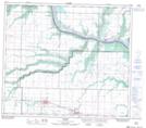
Maps showing Rycroft, 16-78-5-W6, Alberta
Rycroft is a Village located in 16-78-5-W6, Alberta and has an elevation of 606 meters.
- Latitude: 55° 45' 21'' North (decimal: 55.7558332)
- Longitude: 118° 42' 31'' West (decimal: -118.7086110)
- Topography Feature Category: Village
- Geographical Feature: Village
- Canadian Province/Territory: Alberta
- Elevation: 606 meters
- Location: 16-78-5-W6
- Atlas of Canada Locator Map: Rycroft
- GPS Coordinate Locator Map: Rycroft Lat/Long
Rycroft NTS Map Sheets