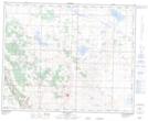
Maps showing Sabine, 26-37-19-W4, Alberta
Sabine is a Unincorporated area located in 26-37-19-W4, Alberta and has an elevation of 835 meters.
- Latitude: 52° 12' 27'' North (decimal: 52.2075000)
- Longitude: 112° 36' 32'' West (decimal: -112.6088889)
- Topography Feature Category: Unincorporated area
- Geographical Feature: Locality
- Canadian Province/Territory: Alberta
- Elevation: 835 meters
- Location: 26-37-19-W4
- Atlas of Canada Locator Map: Sabine
- GPS Coordinate Locator Map: Sabine Lat/Long
Sabine NTS Map Sheets