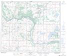
Maps showing Saddle Lake, 34-57-12-W4, Alberta
Saddle Lake is a Unincorporated area located in 34-57-12-W4, Alberta and has an elevation of 615 meters.
- Latitude: 53° 58' 6'' North (decimal: 53.9683333)
- Longitude: 111° 41' 31'' West (decimal: -111.6919444)
- Topography Feature Category: Unincorporated area
- Geographical Feature: Hamlet
- Canadian Province/Territory: Alberta
- Elevation: 615 meters
- Location: 34-57-12-W4
- Atlas of Canada Locator Map: Saddle Lake
- GPS Coordinate Locator Map: Saddle Lake Lat/Long
Saddle Lake NTS Map Sheets