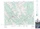
Maps showing Saddle Peak, 26-9-W5, Alberta
Saddle Peak is a Mountain located in 26-9-W5, Alberta and has an elevation of 2514 meters.
- Latitude: 51° 13' 55'' North (decimal: 51.2319444)
- Longitude: 115° 13' 29'' West (decimal: -115.2247222)
- Topography Feature Category: Mountain
- Geographical Feature: Peak
- Canadian Province/Territory: Alberta
- Elevation: 2514 meters
- Location: 26-9-W5
- Atlas of Canada Locator Map: Saddle Peak
- GPS Coordinate Locator Map: Saddle Peak Lat/Long