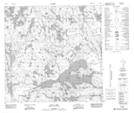
Maps showing St. Agnes Lake, 123-2-W4, Alberta
St. Agnes Lake is a Lake located in 123-2-W4, Alberta and has an elevation of 316 meters.
- Latitude: 59° 40' 52'' North (decimal: 59.6811111)
- Longitude: 110° 13' 57'' West (decimal: -110.2325000)
- Topography Feature Category: Lake
- Geographical Feature: Lake
- Canadian Province/Territory: Alberta
- Elevation: 316 meters
- Location: 123-2-W4
- Atlas of Canada Locator Map: St. Agnes Lake
- GPS Coordinate Locator Map: St. Agnes Lake Lat/Long
St. Agnes Lake NTS Map Sheets