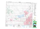
Maps showing St. Albert, 4-54-25-W4, Alberta
St. Albert is a City located in 4-54-25-W4, Alberta and has an elevation of 676 meters.
- Latitude: 53° 38' 13'' North (decimal: 53.6369444)
- Longitude: 113° 37' 13'' West (decimal: -113.6202777)
- Topography Feature Category: City
- Geographical Feature: City
- Canadian Province/Territory: Alberta
- Elevation: 676 meters
- Location: 4-54-25-W4
- Atlas of Canada Locator Map: St. Albert
- GPS Coordinate Locator Map: St. Albert Lat/Long