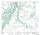
Maps showing St. Isidore, 21-83-20-W5, Alberta
St. Isidore is a Unincorporated area located in 21-83-20-W5, Alberta and has an elevation of 572 meters.
- Latitude: 56° 12' 17'' North (decimal: 56.2047222)
- Longitude: 117° 6' 24'' West (decimal: -117.1066666)
- Topography Feature Category: Unincorporated area
- Geographical Feature: Locality
- Canadian Province/Territory: Alberta
- Elevation: 572 meters
- Location: 21-83-20-W5
- Atlas of Canada Locator Map: St. Isidore
- GPS Coordinate Locator Map: St. Isidore Lat/Long
St. Isidore NTS Map Sheets