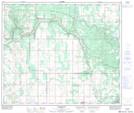
Maps showing St. Lina, 20-61-10-W4, Alberta
St. Lina is a Unincorporated area located in 20-61-10-W4, Alberta and has an elevation of 614 meters.
- Latitude: 54° 17' 46'' North (decimal: 54.2961111)
- Longitude: 111° 27' 13'' West (decimal: -111.4536111)
- Topography Feature Category: Unincorporated area
- Geographical Feature: Hamlet
- Canadian Province/Territory: Alberta
- Elevation: 614 meters
- Location: 20-61-10-W4
- Atlas of Canada Locator Map: St. Lina
- GPS Coordinate Locator Map: St. Lina Lat/Long
St. Lina NTS Map Sheets