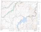
Maps showing St. Mary Reservoir, 4-24,25-W4, Alberta
St. Mary Reservoir is a Lake located in 4-24,25-W4, Alberta and has an elevation of 1105 meters.
- Latitude: 49° 19' 15'' North (decimal: 49.3208333)
- Longitude: 113° 12' 42'' West (decimal: -113.2116667)
- Topography Feature Category: Lake
- Geographical Feature: Reservoir
- Canadian Province/Territory: Alberta
- Elevation: 1105 meters
- Location: 4-24,25-W4
- Atlas of Canada Locator Map: St. Mary Reservoir
- GPS Coordinate Locator Map: St. Mary Reservoir Lat/Long