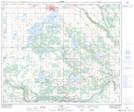
Maps showing St. Paul, 8-58-9-W4, Alberta
St. Paul is a Town located in 8-58-9-W4, Alberta and has an elevation of 644 meters.
- Latitude: 53° 59' 34'' North (decimal: 53.9927777)
- Longitude: 111° 17' 46'' West (decimal: -111.2961110)
- Topography Feature Category: Town
- Geographical Feature: Town
- Canadian Province/Territory: Alberta
- Elevation: 644 meters
- Location: 8-58-9-W4
- Atlas of Canada Locator Map: St. Paul
- GPS Coordinate Locator Map: St. Paul Lat/Long