Maps showing County of St. Paul No. 19, 57-9-W4, Alberta
County of St. Paul No. 19 is a Major municipal/district area - major agglomeration located in 57-9-W4, Alberta.
- Latitude: 53° 55' 59'' North (decimal: 53.9330555)
- Longitude: 111° 18' 58'' West (decimal: -111.3161111)
- Topography Feature Category: Major municipal/district area - major agglomeration
- Geographical Feature: Municipal District
- Canadian Province/Territory: Alberta
- Location: 57-9-W4
- Atlas of Canada Locator Map: County of St. Paul No. 19
- GPS Coordinate Locator Map: County of St. Paul No. 19 Lat/Long
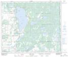
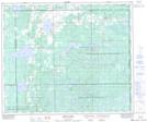
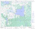
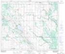
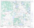
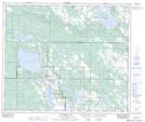
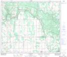
County of St. Paul No. 19 NTS Map Sheets
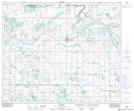
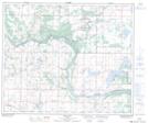
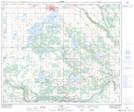
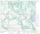
073E11 Myrnam Topographic Map at 1:50,000 scale
073E13 Hairy Hill Topographic Map at 1:50,000 scale
073E14 St Paul Topographic Map at 1:50,000 scale
073E15 Elk Point Topographic Map at 1:50,000 scale
073E16 Frog Lake Topographic Map at 1:50,000 scale
073L01 Reita Lake Topographic Map at 1:50,000 scale
073L02 Muriel Lake Topographic Map at 1:50,000 scale
073L03 Vincent Lake Topographic Map at 1:50,000 scale
073L04 Cache Lake Topographic Map at 1:50,000 scale
073L05 Goodfish Lake Topographic Map at 1:50,000 scale
073L06 Goodridge Topographic Map at 1:50,000 scale
073E Vermilion Topographic Map at 1:250,000 scale
073L Sand River Topographic Map at 1:250,000 scale