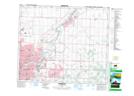
Maps showing St. Paul Junction, 31-53-23-W4, Alberta
St. Paul Junction is a Unincorporated area located in 31-53-23-W4, Alberta and has an elevation of 654 meters.
- Latitude: 53° 37' 20'' North (decimal: 53.6222221)
- Longitude: 113° 22' 50'' West (decimal: -113.3805556)
- Topography Feature Category: Unincorporated area
- Geographical Feature: Urban Community
- Canadian Province/Territory: Alberta
- Elevation: 654 meters
- Location: 31-53-23-W4
- Atlas of Canada Locator Map: St. Paul Junction
- GPS Coordinate Locator Map: St. Paul Junction Lat/Long