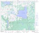
Maps showing St. Pierre Lake, 32-58-5-W4, Alberta
St. Pierre Lake is a Lake located in 32-58-5-W4, Alberta and has an elevation of 679 meters.
- Latitude: 54° 3' 44'' North (decimal: 54.0622222)
- Longitude: 110° 43' 18'' West (decimal: -110.7216667)
- Topography Feature Category: Lake
- Geographical Feature: Lake
- Canadian Province/Territory: Alberta
- Elevation: 679 meters
- Location: 32-58-5-W4
- Atlas of Canada Locator Map: St. Pierre Lake
- GPS Coordinate Locator Map: St. Pierre Lake Lat/Long
St. Pierre Lake NTS Map Sheets