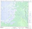
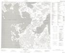
Maps showing Sall River, 110-11-W4, Alberta
Sall River is a River located in 110-11-W4, Alberta and has an elevation of 220 meters.
- Latitude: 58° 30' 42'' North (decimal: 58.5117499)
- Longitude: 111° 48' 29'' West (decimal: -111.8079170)
- Topography Feature Category: River
- Geographical Feature: River
- Canadian Province/Territory: Alberta
- Elevation: 220 meters
- Location: 110-11-W4
- Atlas of Canada Locator Map: Sall River
- GPS Coordinate Locator Map: Sall River Lat/Long
Sall River NTS Map Sheets