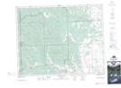
Maps showing Salter Creek, 30-28-6-W5, Alberta
Salter Creek is a River located in 30-28-6-W5, Alberta.
- Latitude: 51° 25' North (decimal: 51.4166670)
- Longitude: 114° 50' West (decimal: -114.8333299)
- Topography Feature Category: River
- Geographical Feature: Creek
- Canadian Province/Territory: Alberta
- Location: 30-28-6-W5
- Atlas of Canada Locator Map: Salter Creek
- GPS Coordinate Locator Map: Salter Creek Lat/Long
Salter Creek NTS Map Sheets