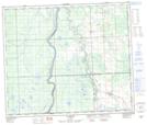
Maps showing Samuel Lake, 64-2-W5, Alberta
Samuel Lake is a Lake located in 64-2-W5, Alberta and has an elevation of 621 meters.
- Latitude: 54° 35' 10'' North (decimal: 54.5861111)
- Longitude: 114° 12' 8'' West (decimal: -114.2022221)
- Topography Feature Category: Lake
- Geographical Feature: Lake
- Canadian Province/Territory: Alberta
- Elevation: 621 meters
- Location: 64-2-W5
- Atlas of Canada Locator Map: Samuel Lake
- GPS Coordinate Locator Map: Samuel Lake Lat/Long
Samuel Lake NTS Map Sheets