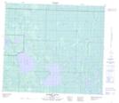
Maps showing Sandy Lake, 79-22-W4, Alberta
Sandy Lake is a Lake located in 79-22-W4, Alberta and has an elevation of 558 meters.
- Latitude: 55° 49' 56'' North (decimal: 55.8322221)
- Longitude: 113° 23' 12'' West (decimal: -113.3866666)
- Topography Feature Category: Lake
- Geographical Feature: Lake
- Canadian Province/Territory: Alberta
- Elevation: 558 meters
- Location: 79-22-W4
- Atlas of Canada Locator Map: Sandy Lake
- GPS Coordinate Locator Map: Sandy Lake Lat/Long
Sandy Lake NTS Map Sheets