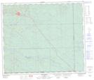
Maps showing Sarah Creek, 64-9-W5, Alberta
Sarah Creek is a River located in 64-9-W5, Alberta and has an elevation of 961 meters.
- Latitude: 54° 33' 19'' North (decimal: 54.5552777)
- Longitude: 115° 16' 57'' West (decimal: -115.2825000)
- Topography Feature Category: River
- Geographical Feature: Creek
- Canadian Province/Territory: Alberta
- Elevation: 961 meters
- Location: 64-9-W5
- Atlas of Canada Locator Map: Sarah Creek
- GPS Coordinate Locator Map: Sarah Creek Lat/Long
Sarah Creek NTS Map Sheets