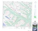
Maps showing Glacier Pass Trail, Alberta
Glacier Pass Trail is a Road feature located in Alberta and has an elevation of 1823 meters.
- Latitude: 53° 30' 5'' North (decimal: 53.5014000)
- Longitude: 118° 51' 00'' West (decimal: -118.8499999)
- Topography Feature Category: Road feature
- Geographical Feature: Trail
- Canadian Province/Territory: Alberta
- Elevation: 1823 meters
- Atlas of Canada Locator Map: Glacier Pass Trail
- GPS Coordinate Locator Map: Glacier Pass Trail Lat/Long
Glacier Pass Trail NTS Map Sheets