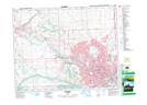
Maps showing Glenbow, 29-25-3-W5, Alberta
Glenbow is a Unincorporated area located in 29-25-3-W5, Alberta and has an elevation of 1133 meters.
- Latitude: 51° 9' 32'' North (decimal: 51.1588888)
- Longitude: 114° 23' 6'' West (decimal: -114.3849999)
- Topography Feature Category: Unincorporated area
- Geographical Feature: Locality
- Canadian Province/Territory: Alberta
- Elevation: 1133 meters
- Location: 29-25-3-W5
- Atlas of Canada Locator Map: Glenbow
- GPS Coordinate Locator Map: Glenbow Lat/Long