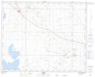
Maps showing Godfrey Lake, 35-12,13-W4, Alberta
Godfrey Lake is a Lake located in 35-12,13-W4, Alberta and has an elevation of 811 meters.
- Latitude: 52° 0' 59'' North (decimal: 52.0163889)
- Longitude: 111° 43' 6'' West (decimal: -111.7183333)
- Topography Feature Category: Lake
- Geographical Feature: Lake
- Canadian Province/Territory: Alberta
- Elevation: 811 meters
- Location: 35-12,13-W4
- Atlas of Canada Locator Map: Godfrey Lake
- GPS Coordinate Locator Map: Godfrey Lake Lat/Long