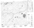
Maps showing Godin Lake, 82-1-W4, Alberta
Godin Lake is a Lake located in 82-1-W4, Alberta.
- Latitude: 56° 5' 42'' North (decimal: 56.0949999)
- Longitude: 114° 3' 1'' West (decimal: -114.0502777)
- Topography Feature Category: Lake
- Geographical Feature: Lake
- Canadian Province/Territory: Alberta
- Location: 82-1-W4
- Atlas of Canada Locator Map: Godin Lake
- GPS Coordinate Locator Map: Godin Lake Lat/Long
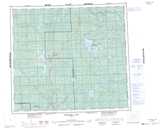
Godin Lake NTS Map Sheets