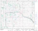
Maps showing Godson Lake, 10-49-10-W4, Alberta
Godson Lake is a Lake located in 10-49-10-W4, Alberta and has an elevation of 686 meters.
- Latitude: 53° 12' 16'' North (decimal: 53.2044444)
- Longitude: 111° 23' 38'' West (decimal: -111.3938888)
- Topography Feature Category: Lake
- Geographical Feature: Lake
- Canadian Province/Territory: Alberta
- Elevation: 686 meters
- Location: 10-49-10-W4
- Atlas of Canada Locator Map: Godson Lake
- GPS Coordinate Locator Map: Godson Lake Lat/Long
Godson Lake NTS Map Sheets