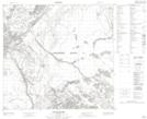
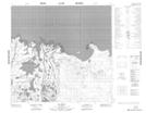
Maps showing Goose Island Channel, 109,110-6-W4, Alberta
Goose Island Channel is a Channel located in 109,110-6-W4, Alberta and has an elevation of 233 meters.
- Latitude: 58° 33' 38'' North (decimal: 58.5605279)
- Longitude: 110° 50' 35'' West (decimal: -110.8431939)
- Topography Feature Category: Channel
- Geographical Feature: Channel
- Canadian Province/Territory: Alberta
- Elevation: 233 meters
- Location: 109,110-6-W4
- Atlas of Canada Locator Map: Goose Island Channel
- GPS Coordinate Locator Map: Goose Island Channel Lat/Long
Goose Island Channel NTS Map Sheets