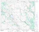
Maps showing Mallaig, 25-60-10-W4, Alberta
Mallaig is a Unincorporated area located in 25-60-10-W4, Alberta and has an elevation of 628 meters.
- Latitude: 54° 12' 37'' North (decimal: 54.2102778)
- Longitude: 111° 21' 39'' West (decimal: -111.3608332)
- Topography Feature Category: Unincorporated area
- Geographical Feature: Hamlet
- Canadian Province/Territory: Alberta
- Elevation: 628 meters
- Location: 25-60-10-W4
- Atlas of Canada Locator Map: Mallaig
- GPS Coordinate Locator Map: Mallaig Lat/Long
Mallaig NTS Map Sheets