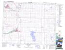
Maps showing Maple Leaf (Sitook-Spagkway), 20-29-W4, Alberta
Maple Leaf (Sitook-Spagkway) is a Mountain located in 20-29-W4, Alberta and has an elevation of 1169 meters.
- Latitude: 50° 39' 26'' North (decimal: 50.6572222)
- Longitude: 113° 59' 2'' West (decimal: -113.9838889)
- Topography Feature Category: Mountain
- Geographical Feature: Hill
- Canadian Province/Territory: Alberta
- Elevation: 1169 meters
- Location: 20-29-W4
- Atlas of Canada Locator Map: Maple Leaf (Sitook-Spagkway)
- GPS Coordinate Locator Map: Maple Leaf (Sitook-Spagkway) Lat/Long
Maple Leaf (Sitook-Spagkway) NTS Map Sheets