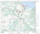
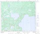
Maps showing Marie Lake, 65-2,3-W4, Alberta
Marie Lake is a Lake located in 65-2,3-W4, Alberta and has an elevation of 569 meters.
- Latitude: 54° 37' 58'' North (decimal: 54.6327777)
- Longitude: 110° 17' 53'' West (decimal: -110.2980556)
- Topography Feature Category: Lake
- Geographical Feature: Lake
- Canadian Province/Territory: Alberta
- Elevation: 569 meters
- Location: 65-2,3-W4
- Atlas of Canada Locator Map: Marie Lake
- GPS Coordinate Locator Map: Marie Lake Lat/Long
Marie Lake NTS Map Sheets