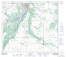
Maps showing Marie-Reine, 6-82-21-W5, Alberta
Marie-Reine is a Unincorporated area located in 6-82-21-W5, Alberta and has an elevation of 566 meters.
- Latitude: 56° 4' 35'' North (decimal: 56.0763888)
- Longitude: 117° 17' 22'' West (decimal: -117.2894444)
- Topography Feature Category: Unincorporated area
- Geographical Feature: Hamlet
- Canadian Province/Territory: Alberta
- Elevation: 566 meters
- Location: 6-82-21-W5
- Atlas of Canada Locator Map: Marie-Reine
- GPS Coordinate Locator Map: Marie-Reine Lat/Long
Marie-Reine NTS Map Sheets