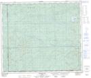
Maps showing Marigold Lake, 32-65-11-W5, Alberta
Marigold Lake is a Lake located in 32-65-11-W5, Alberta and has an elevation of 1121 meters.
- Latitude: 54° 40' North (decimal: 54.6666666)
- Longitude: 115° 37' West (decimal: -115.6166667)
- Topography Feature Category: Lake
- Geographical Feature: Lake
- Canadian Province/Territory: Alberta
- Elevation: 1121 meters
- Location: 32-65-11-W5
- Atlas of Canada Locator Map: Marigold Lake
- GPS Coordinate Locator Map: Marigold Lake Lat/Long
Marigold Lake NTS Map Sheets