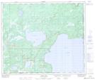
Maps showing Martineau River, 14-65-1-W4, Alberta
Martineau River is a River located in 14-65-1-W4, Alberta and has an elevation of 543 meters.
- Latitude: 54° 37' 29'' North (decimal: 54.6247221)
- Longitude: 110° 2' 10'' West (decimal: -110.0361111)
- Topography Feature Category: River
- Geographical Feature: River
- Canadian Province/Territory: Alberta
- Elevation: 543 meters
- Location: 14-65-1-W4
- Atlas of Canada Locator Map: Martineau River
- GPS Coordinate Locator Map: Martineau River Lat/Long
Martineau River NTS Map Sheets