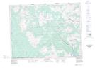
Maps showing Blue Grouse Basin, 13-2-2-W5, Alberta
Blue Grouse Basin is a Valley located in 13-2-2-W5, Alberta and has an elevation of 2051 meters.
- Latitude: 49° 7' 25'' North (decimal: 49.1236110)
- Longitude: 114° 8' 58'' West (decimal: -114.1494444)
- Topography Feature Category: Valley
- Geographical Feature: Basin
- Canadian Province/Territory: Alberta
- Elevation: 2051 meters
- Location: 13-2-2-W5
- Atlas of Canada Locator Map: Blue Grouse Basin
- GPS Coordinate Locator Map: Blue Grouse Basin Lat/Long