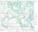
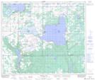
Maps showing Bluet Lake, 58-4-W4, Alberta
Bluet Lake is a Lake located in 58-4-W4, Alberta.
- Latitude: 54° 0' 30'' North (decimal: 54.0083000)
- Longitude: 110° 34' 40'' West (decimal: -110.5777999)
- Topography Feature Category: Lake
- Geographical Feature: Lake
- Canadian Province/Territory: Alberta
- Location: 58-4-W4
- GPS Coordinate Locator Map: Bluet Lake Lat/Long
Bluet Lake NTS Map Sheets